Protecting Atlantic Sturgeon: How Ocean Observing Systems Are Helping Conserve an Endangered Species
The Atlantic sturgeon (Acipenser oxyrinchus oxyrinchus) is an ancient fish that has inhabited the waters off the East Coast of North America for millions of years. Once abundant in rivers and coastal waters from Canada to Florida, their populations have drastically declined due to overfishing, habitat destruction, and other human impacts. Today, all U.S. Atlantic sturgeon populations are listed as either endangered or threatened under the Endangered Species Act (ESA). In 2017, parts of the Delaware River were designated as critical habitat, recognizing the region’s importance to the species’ survival. Adult sturgeon migrate into the river to spawn each spring, and Delaware Bay and its surrounding estuaries serve as vital nursery grounds where young sturgeon grow and develop before heading to the open ocean.

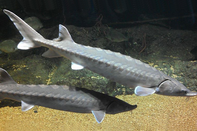
Atlantic Sturgeon, photo credit NOAA
As conservation efforts work to rebuild these populations, understanding when and where sturgeon are likely to be present in Delaware Bay is critical. To support this need, the Atlantic Sturgeon Risk of Encounter Product—based on the Atlantic Sturgeon Occurrence Model (ASOM) and developed through a collaboration among MARACOOS, NOAA, and NASA—provides timely, science-based insights to guide resource managers and reduce human impacts on this vulnerable species.
Why Do Atlantic Sturgeon Need Protection?
Atlantic sturgeon are anadromous, which means that they are born in freshwater, migrate to the ocean as juveniles, and return to rivers to spawn as adults. These fish can live up to 60 years and grow up to 14 feet long, weighing as much as 800 pounds.
The presence of Atlantic sturgeon is a great indicator of water quality because they need clean substrate and oxygenated freshwater to successfully spawn. Their presence is an indicator to researchers of a clean and balanced ecosystem.
Unfortunately, their numbers began declining in the last century due to overfishing and harvesting for their eggs. The Delaware River once supported the largest sturgeon fishery on the East Coast, but their populations collapsed in the late 1800s. Despite capture prohibitions and improved water quality and habitat in coastal rivers, populations still struggle to recover. Their slow growth and late maturity leave them vulnerable to human threats, with the primary threats to Atlantic sturgeon being:
- Bycatch in commercial fishing – Sturgeon often become unintentionally caught in gill nets and trawl fisheries, leading to injury or death.
- Habitat destruction – Dredging, water removal, and poor water quality negatively impact sturgeon spawning grounds and juvenile habitats.
- Vessel strikes – Sturgeon are frequently struck by ships, particularly in the high-traffic waters of the Delaware and Hudson Rivers.
To help protect sturgeon while reducing the regulatory burdens on fishing and coastal construction, commercial fishers and marine resource managers need an accurate understanding of when and where sturgeon occur so that actions can be taken to protect them during critical times of the year.
The Atlantic Sturgeon Risk of Encounter Product
The Atlantic Sturgeon Risk of Encounter Product uses the Atlantic Sturgeon Occurrence Model (ASOM), a predictive model designed by researchers at the University of Delaware, in partnership with MARACOOS, NOAA, and NASA. This product predicts the presence of Atlantic sturgeon in Delaware Bay and surrounding waters, using satellite-derived environmental data, including:
- Sea surface temperature (SST) – Sturgeon movements are linked to seasonal water temperature changes.
- Ocean color – This helps identify signals in ocean productivity and estuarine sources that influence sturgeon habitat.
- Water depth and time of year – These play a key role in where and when sturgeon are likely to be found.

The Atlantic Sturgeon Risk of Encounter Product as displayed in our OceansMap data portal.
One of the biggest challenges in forecasting sturgeon presence is missing satellite data, often caused by cloud cover. To address this, the ASOM incorporates Data Interpolating Empirical Orthogonal Functions (DINEOF), a mathematical technique that fills in missing satellite data using past observations. This allows the ASOM to generate more complete and accurate forecasts, even when direct satellite observations are unavailable.
This information is used to create maps that indicate risk of encounter, with the product providing Atlantic sturgeon forecasts up to three days in advance. The tool uses a simple three-color system, with green indicating low risk, yellow indicating medium risk and red indicating high risk of encounter. This helps state and federal agencies, fisheries managers, and commercial fishers make informed decisions to reduce sturgeon interactions.
Due to its success in Delaware Bay, the model is attracting attention from other regions along the Atlantic Coast where sturgeon are found, and additional funding was recently from NASA and are currently seeking a postdoctoral researcher to support the expansion of this product beyond the Delaware Bay. “The success of this deployed product in the Delaware Bay has piqued interest from federal and state agencies in other parts of Atlantic sturgeon’s range that strive to reduce interactions with this endangered species while limiting future regulatory burdens,” says Dr. Matthew Breece, Assistant Professor of Marine Science at St. Mary’s College of Maryland, and co-developer of the model.
Of its success in the region and need for expansion outside of Delaware Bay, Dr. Edward Hale, Assistant Professor at the University of Delaware says, “This product has been well received by both the fishing community and natural resource managers in Delaware Bay, which is exactly what we hoped for. For commercial fishers using small mesh gillnets, accidentally catching sturgeon isn’t just a conservation concern—it’s a financial one too, because these large fish can destroy their gear. The simple red, yellow, and green system makes it easy for them to quickly understand risk and adjust their plans to avoid costly interactions. On the management side, agencies have found the web portal to be an informative and practical tool to support conservation efforts. As we continue gathering user feedback, we’re looking at how we can expand the product beyond Delaware Bay and potentially reinstate text alerts in the future to keep supporting both efficient fishing and Atlantic sturgeon protection.”
The Role MARACOOS Plays in Protecting Atlantic Sturgeon
MARACOOS is proud to be a supporter of the work being done to create the model and data product, and the data is available in our near-real-time data portal, OceansMap. As one of eleven certified U.S. IOOS regional associations, MARACOOS is dedicated to delivering high-quality ocean and coastal data to stakeholders, partners, and the public. OceansMap provides free and open access to critical data products that support decision-making in the Mid-Atlantic region, spanning from Cape Cod, MA, to Cape Hatteras, NC.
—
As one of eleven certified U.S. IOOS regional associations, MARACOOS is dedicated to delivering high-quality ocean and coastal data to stakeholders, partners, and the public.


No responses yet