
A Harmful Algal Bloom in the lower Chesapeake Bay highlights the value of an enhanced regional monitoring and response network
The first sign something was amiss in the Bay arrived by email. A few cells of the harmful algae, Margalefidinium polykrikoides (Marge, for short), were found in a water sample collected near the Norfolk Yacht and Country Club (Figure 1). By July 9, communications between Virginia academic and state agency scientists, MARACOOS, and the National Oceanic and Atmospheric Administration (NOAA) Harmful Algal Bloom (HAB) forecasting team noted increasing cell counts of Marge in water samples taken from the York River. Not even two weeks later, water samples indicated Marge was in full bloom in the York River and Lafayette River. Marge was here, and bloom conditions were rapidly expanding across the bay.
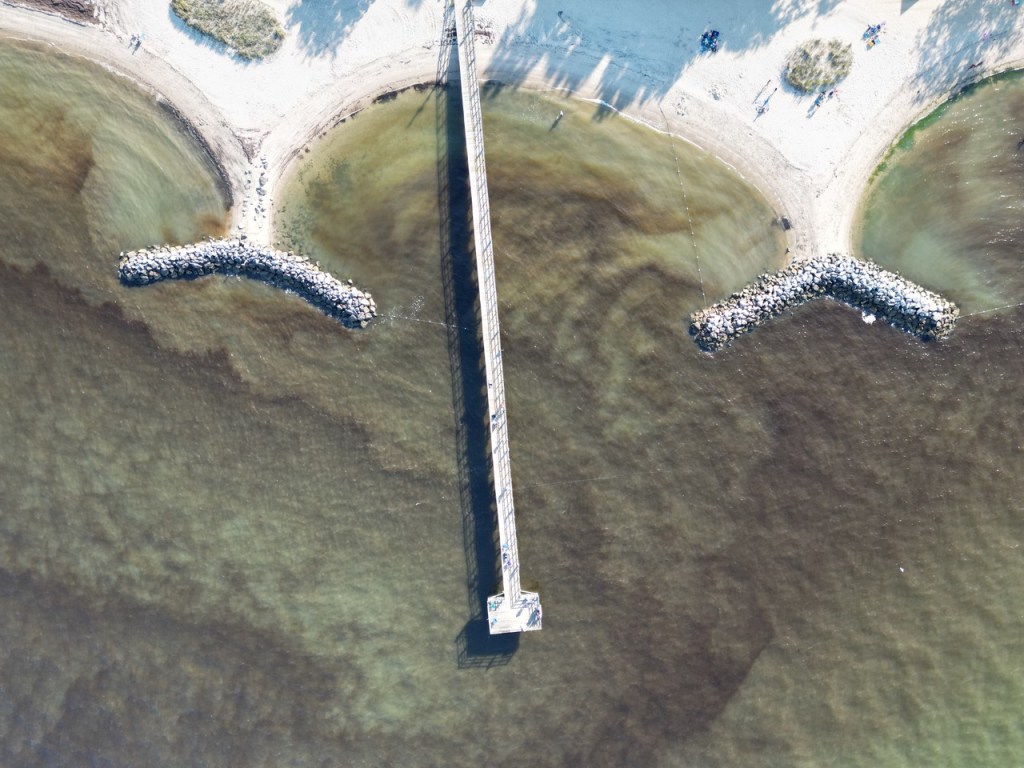
Marge, known for its rust-colored tides (Figure 2), is not new to the Chesapeake Bay. While blooms occur almost annually, 2025 was a quiet summer, challenging scientists to further explore the exact conditions that allow Marge populations to develop into a dense bloom. Harmful to fish and shellfish, scientists and modelers are working to understand the conditions that fuel these and other harmful algal blooms, forecast the path it will take, and provide early warning to resource managers and communities.
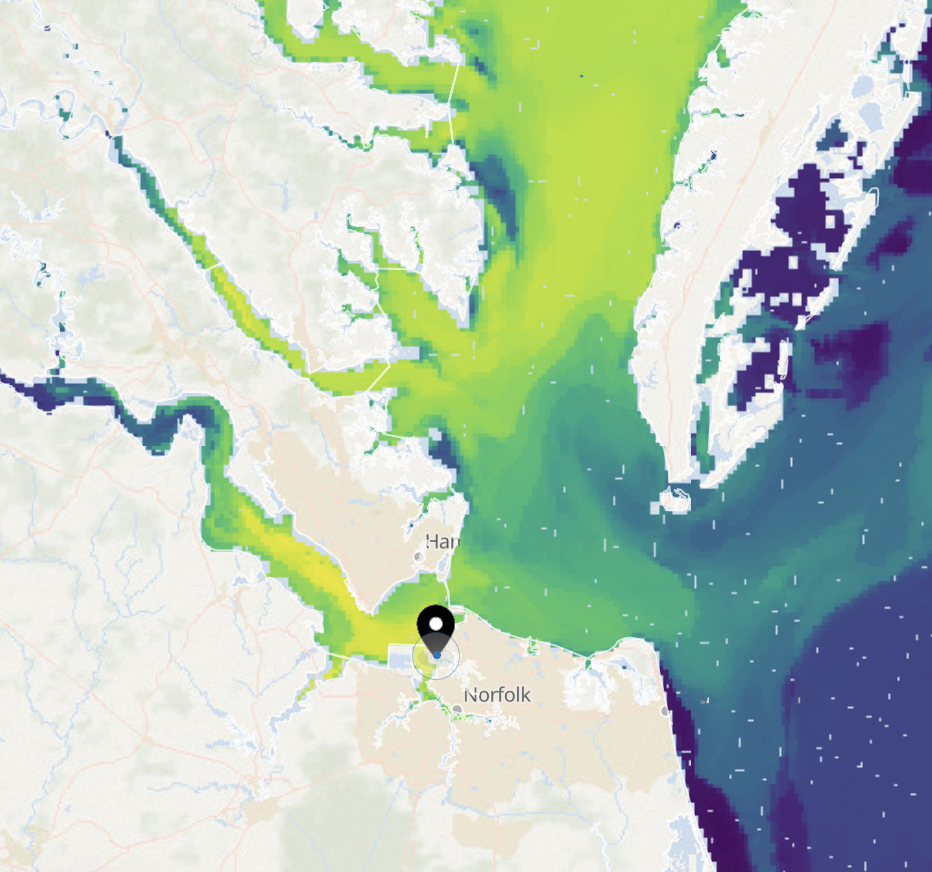

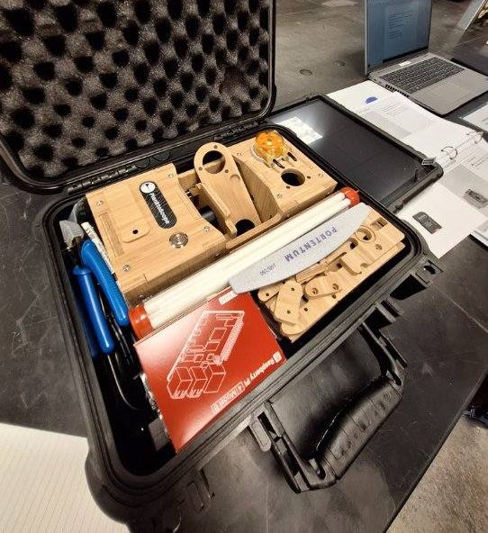
This bloom is the first test of a pilot monitoring network being funded largely by a NOAA National Centers for Coastal Ocean Science (NCCOS) Monitoring and Event Response for Harmful Algal Bloom (MERHAB) research project to develop a regional HAB monitoring and response network for the lower Chesapeake Bay. The project team, which includes MARACOOS, is testing the value of integrating a range of cutting edge monitoring technologies from high throughput Imaging Flow Cytobots (IFCBs) to low-cost PlanktoScopes (Figure 3 & Figure 4) with data from existing state and bay-wide monitoring efforts. Leveraging MARACOOS leadership and IOOS funding, the team is exploring ways to more effectively integrate and share satellite imagery, monitoring data, and region-specific image libraries (to help with species ID), into a single, publicly accessible portal. The resulting enhanced monitoring system is helping partners better track the extent and intensity of the current bloom and its impacts. This data is informing efforts to better understand and predict conditions that contribute to HAB events in the bay and deliver timely information and improved HAB forecasts to shellfish growers, state and regional managers, charter boat operators, and the public.

The project team continues to explore ways to sustain the enhanced capacity for observing and forecasting beyond NCCOS MERHAB grant funded project. For example, MARACOOS has identified a long-term role to continue as data provider for VA’s regional HAB network.
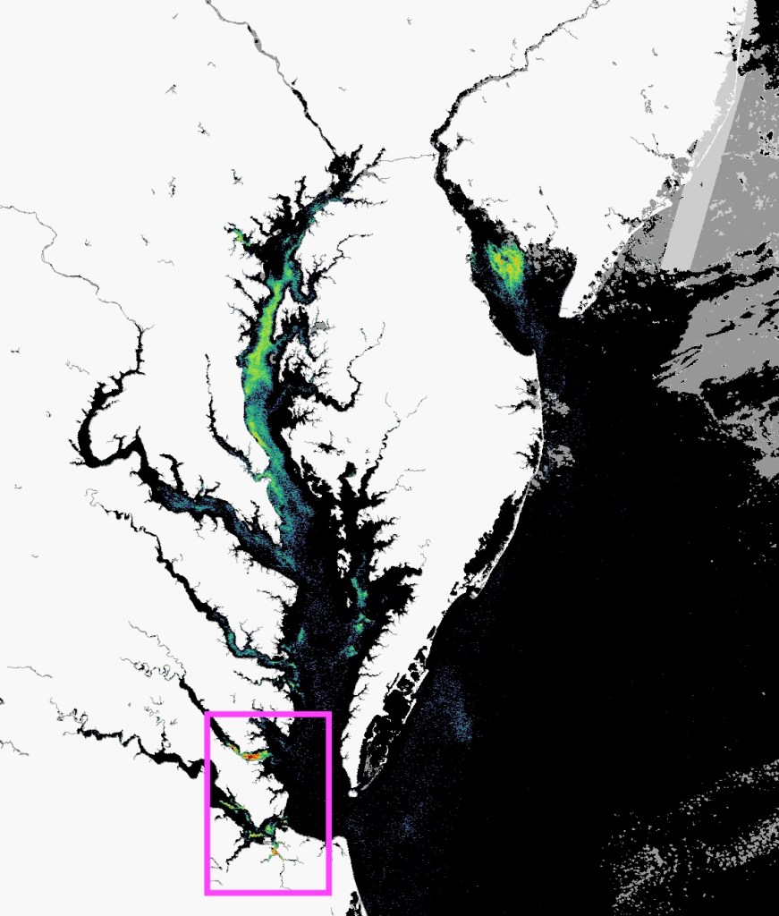
As conditions continue to evolve over the course of this active bloom, the project team has continued to notify each other of local observations and water sample measurements. This network of collaboration has helped scientists and the VDH track where the bloom is peaking and provide observations that support forecasts where bloom conditions may move next. In late July, satellite imagery from the NOAA HAB Forecast team showed chlorophyll hotspots (fluorescent spots on the image in Figure 5) in the James, York, and Lafayette Rivers; modelers from VIMS projected the bloom would be transported into the Chesapeake Bay near Mobjack Bay, Ocean View, and the Lynnhaven River. As Kim Reece, PhD, Professor and co-investigator of MERHAB shares, “Our ongoing MERHAB project field sampling efforts are greatly facilitated by satellite imagery provided by our colleagues at the NOAA’s National Centers for Coastal and Ocean Science. These images enable us to focus sample collection on areas with dense blooms, and then identify the organisms involved back at the lab using microscopic imaging (the PlanktoScope) and molecular tools (qPCR).”
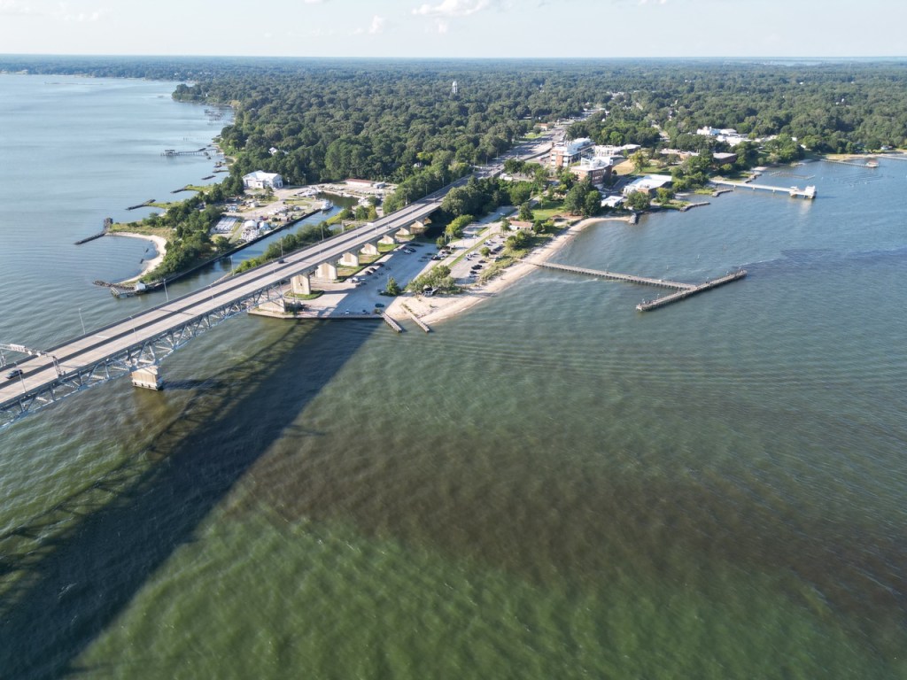
Discussion on the current bloom in the Chesapeake Bay surfaced during one of MARACOOS’ regular operations calls which serve as a check-in for MARACOOS partners, including MERHAB project lead Margie Mulholland, Old Dominion University, across various projects to hear about efforts and observations happening across the region. MARACOOS is one of the regional associations that make up the U.S. Integrated Ocean Observing System (IOOS), coordinating ocean observing efforts across the Mid-Atlantic and working with partners to ensure observing data and products meet stakeholder needs. The discussion of Marge’s presence in the Bay prompted Dr. Donglai Gong, Associate Professor at College of William & Mary VIMS Batten School of Coastal & Marine Science (VIMS), to conduct drone flights over the Lower York River at Gloucester Point for aerial observations (Figure 6 & 7). These aerial observations highlight the extent of the bloom near locations where water samples were initially collected, contributing to the collaborative effort of the regional HAB network.
While the bloom remains active, regional partners continue to work together to track Marge as well as other HABs that may occur with the most recent NOAA forecasts predicting the Marge to reach the Atlantic coast by this weekend. The success of predicting this bloom’s path relies on the collaboration of partners and the coordination of multiple tools for rapidly observing and analyzing the bloom. Satellite imagery showing areas of elevated chlorophyll, water samples identifying which harmful algae are present and at what concentrations, and aerial observations documenting bloom extent each provide a piece of the puzzle.
Looking ahead, MARACOOS, the MERHAB project team, and NOAA HAB forecasting team plan to expand their efforts beyond Virginia to serve the HAB data needs for the entire Chesapeake Bay. MARACOOS plans to build a regional data portal for the Chesapeake Bay. Bringing different streams of data into one central location allows the network to streamline coordination, improve response time when a bloom is detected, and more quickly notify the communities and industries at risk throughout the Bay. The NOAA HAB forecasting team has plans to make the current regional forecast operational.
The MERHAB project is led by Dr. Margaret Mulholland, Old Dominion University. Co-investigators are: Dr. Sophie Clayton and Dr. Eileen Hofmann, Old Dominion University; Dr. Pierre St-Laurent, Dr. Marjy Friedrichs, Dr. Kimberly Reece, Dr. William Reay and Dr. Susanna Musick, Virginia Institute of Marine Science; Mary Ford, Mid-Atlantic Regional Association Coastal Ocean Observing System, and Michelle Tomlinson and Jennifer Maucher Fuquay, NOAA NCCOS.
Partners that will continue to aid in transitioning project results to management entities include the Virginia Departments of Health and Environmental Quality, Maryland Department of Natural Resources, Chesapeake Bay Monitoring Program, NOAA NCCOS, MARACOOS, and Hampton Roads Sanitation District.
Related Posts
Share this post

