MARACOOS News Feed
Read the latest news from MARACOOS and our partners
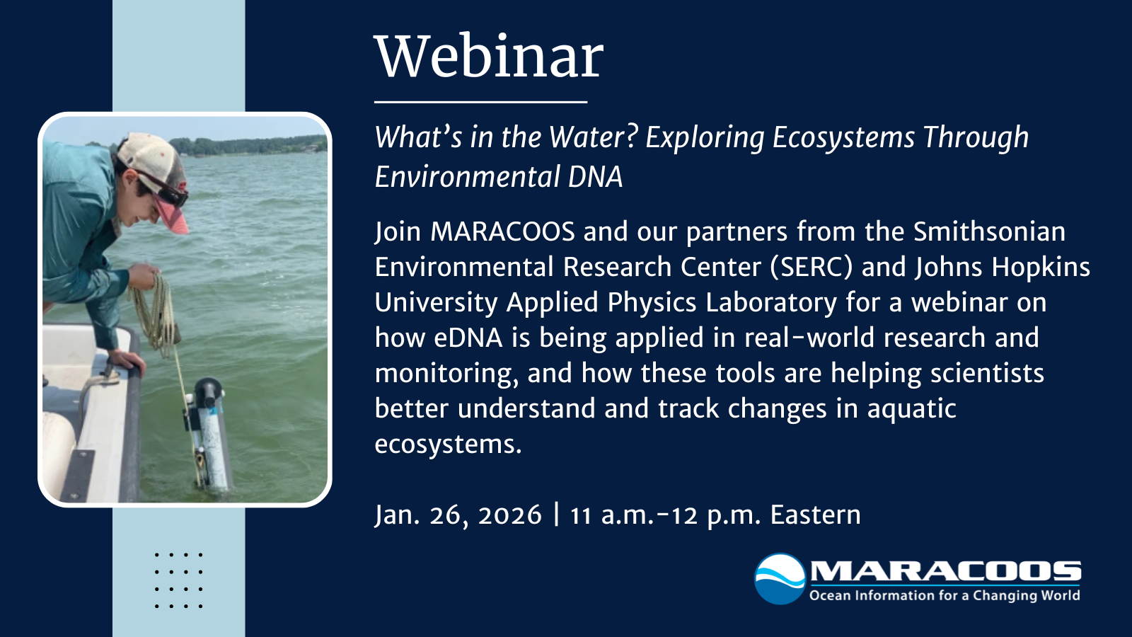
Watch the recording of our most recent webinar, with a presentation of our partners from the Smithsonian Environmental Research Center (SERC).
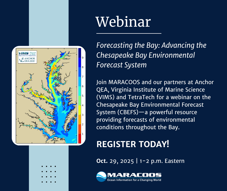
Join us and our partners at Anchor QEA, Virginia Institute of Marine Science (VIMS) and TetraTech for a webinar on Oct. 29 about the Chesapeake Bay Environmental Forecast System (CBEFS)—a powerful resource providing forecasts of environmental conditions throughout the Bay.

Watch our webinar on how sharks are being equipped with sensors to provide data for hurricane forecasting.

Learn how Chesapeake Bay anglers use CBEFS forecasts to track low-oxygen zones, harmful algal blooms, and other conditions for safer, more productive fishing.

MARACOOS board member, Captain Ray Toll, was presented with the Caraid Award, awarded yearly by the IOOS Association, on October 7, 2025.

Recording now available: Watch our latest webinar, hosted with our partners from the University of Delaware, exploring the latest updates to MARACOOS OceansMap—our interactive platform that brings together near-real-time coastal data to support smarter, faster decision-making.

The restored HF radar station at Nauset, Cape Cod, strengthens the MARACOOS CODAR network, delivering real-time ocean surface current data. As the northernmost site, it supports navigation, Coast Guard operations, fisheries, and ecosystem monitoring, filling a vital coverage gap between Mid-Atlantic waters and the Gulf of Maine.
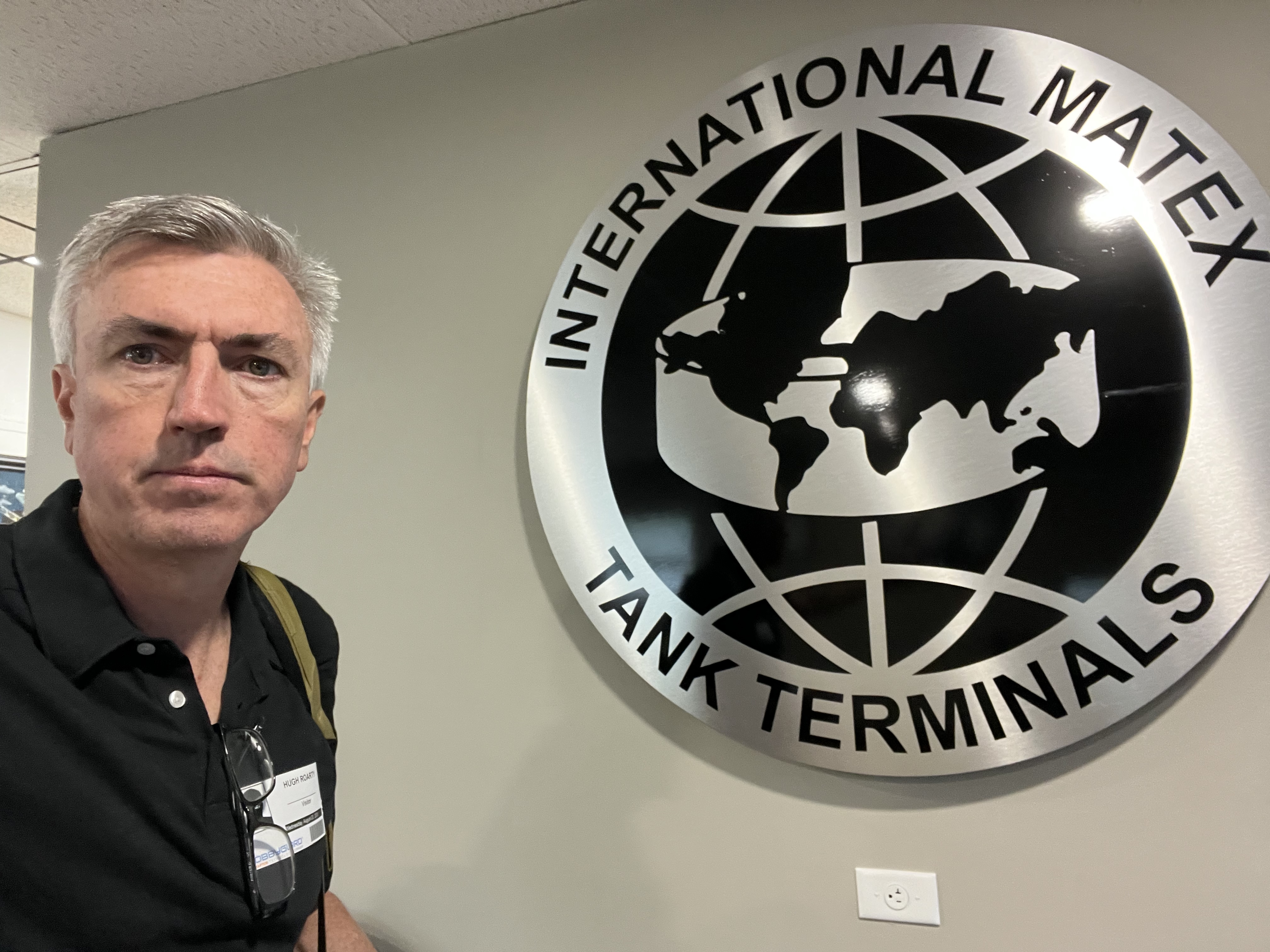
Dr. Hugh Roarty (MARACOOS, Rutgers) shared how real-time ocean data from HF radar, gliders, and buoys supports vessel navigation, spill response, and harbor safety at the Bayonne Harbor Safety meeting, strengthening connections between ocean science and the Port of New York and New Jersey’s operations.
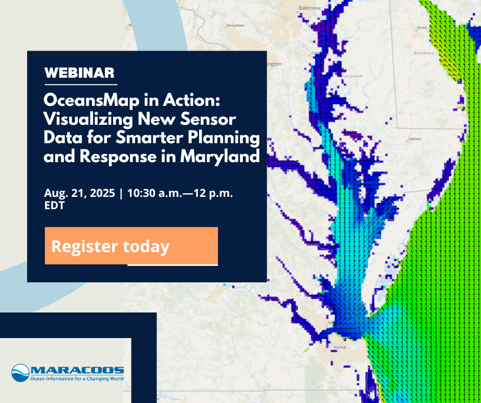
Recording available: Watch MARACOOS and partners from the University of Maryland give a dynamic, data-driven webinar exploring the latest updates to MARACOOS OceansMap—our interactive platform that brings together near-real-time coastal data to support smarter, faster decision-making.

Join MARACOOS for an interactive virtual workshop focused on developing the East Coast Community Operational Forecast System (ECCOFS)—a next-generation ocean model to forecast currents, temperature, salinity and sea levels from the Caribbean to the Grand Banks.
RECORDING NOW AVAILABLE: Watch MARACOOS and partners from Stevens Institute of Technology give a dynamic, data-driven webinar exploring the latest updates to MARACOOS OceansMap—our interactive platform that brings together near-real-time coastal data to support smarter, faster decision-making.

Scientists are tagging Mako sharks with temperature sensors to collect ocean data from hard-to-reach coastal zones in the Mid-Atlantic. This innovative effort helps fill key data gaps, improving hurricane forecasts by capturing conditions in areas where traditional tools like gliders are limited or costly to deploy.

RECORDING NOW AVAILABLE: Watch MARACOOS and partners from the Virginia Institute of Marine Science (VIMS) give a dynamic, data-driven webinar exploring the latest updates to MARACOOS OceansMap—our interactive platform that brings together near-real-time coastal data to support smarter, faster decision-making.

Scientists, students, and coastal experts gathered for the 2025 MACAN Workshop to share the latest ocean acidification research, explore hands-on monitoring techniques, and build regional collaboration. Hosted at SERC, the event featured fieldwork, lab demos, and discussions on nature-based solutions and risk assessment.

A newly upgraded ocean buoy was deployed off the coast of New England on May 9, 2025, to help scientists better monitor and understand the ocean and atmosphere. The data collected are aligned with the data needs of the NWS, NERACOOS, MARACOOS and other stakeholders in the region.

Watch now to discover how Hurricanes Irene and Sandy reshaped hurricane forecasting in this June 11 webinar with Dr. Scott Glenn of Rutgers.

The hearing included bill H.R. 2294, which supports regional observing systems like MARACOOS and would reauthorize the Integrated Coastal and Ocean Observation System Act.

Discover how Hurricanes Irene and Sandy reshaped hurricane forecasting in this June 11 webinar with Dr. Scott Glenn of Rutgers. Learn how underwater gliders emerged as essential tools for improving storm predictions and protecting coastal communities—insights from decades of pioneering ocean observation work you won’t want to miss.
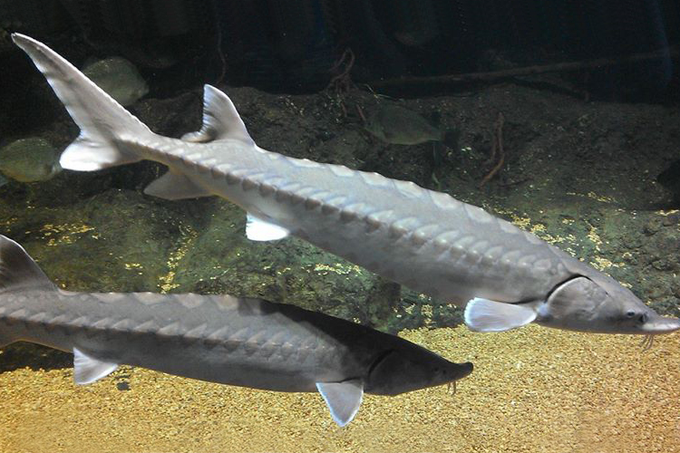
Discover how ocean data is used to protect endangered Atlantic sturgeon in Delaware Bay. The Atlantic Sturgeon Risk of Encounter Product delivers real-time, science-based forecasts to help reduce harmful interactions with this ancient species, while at the same time supporting fisheries management.

The proposed budget cuts to the National Oceanic and Atmospheric Administration (NOAA) threaten to severely impact the nation’s Integrated Ocean Observing System (IOOS), including MARACOOS. The proposed funding reductions could eliminate essential ocean and coastal observation services that protect lives, sustain economic growth, and safeguard public health across the Mid-Atlantic and beyond.

