
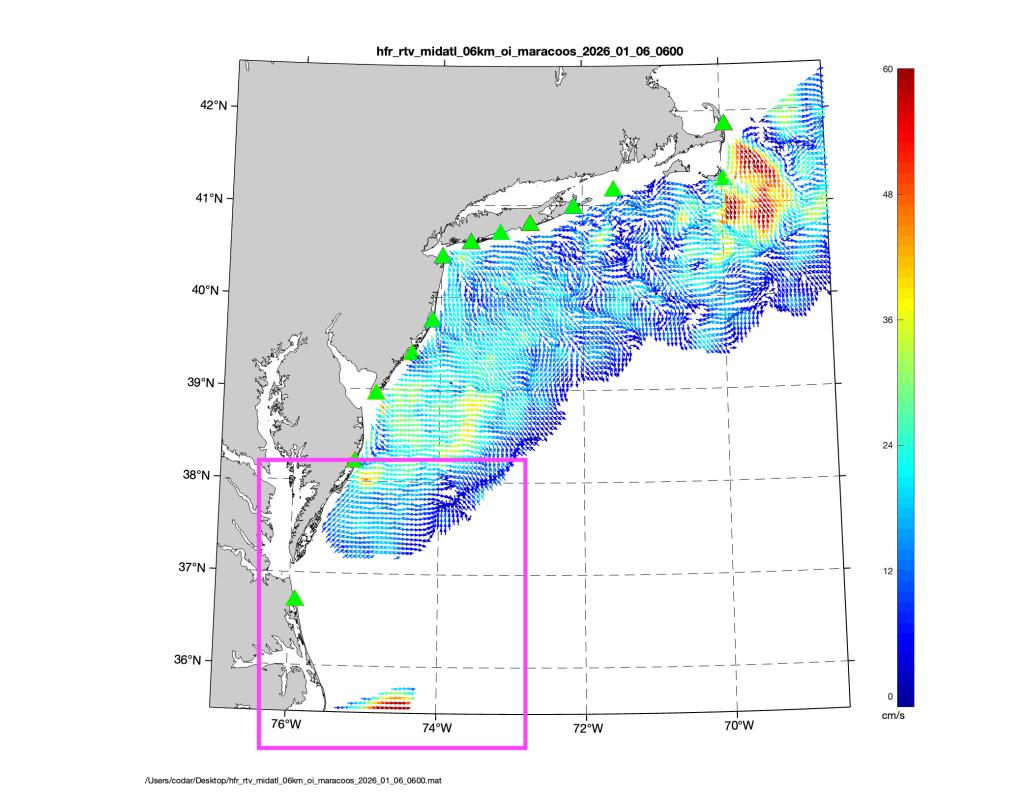
The Cedar Island High Frequency (HF) radar station has returned to service after an extended outage, restoring ocean current measurements off the Eastern Shore. An important station within the MARACOOS HF radar network, the Cedar Island station contributes near real-time hourly surface circulation maps for the southern Mid-Atlantic Bight.
HF radar provides valuable near real-time ocean surface current data and forecasts are used to plan search and rescue missions, respond to oil spills, track harmful algal blooms, and improve maritime safety. MARACOOS’ network of HF radar stations span from Cape Hatteras, North Carolina to Cape Cod, Massachusetts and is part of the U.S. Integrated Ocean Observing System (IOOS) National HF Radar Network, a nationwide system of more than 150 radar stations that delivers standardized, real-time coastal current observations to support maritime commerce, emergency response, environmental monitoring, and ocean forecasting across the United States.
How does HF radar work?
Each radar station uses a transmitter to broadcast electromagnetic waves that scatter off the ocean surface and reflect back to shore where a receiver acquires the return signal.. The data is relayed back to MARACOOS’ operations center for quality control before continuing on to the national data assembly center. The result from the data is a map of surface currents: first as “radials,” or currents moving directly toward or away from a receiving antenna, then combined from multiple stations to produce a complete picture of the ocean surface circulation. The maps are available at MARACOOS OceansMap.
Depending on environmental and operating conditions, the long range radar systems can collect data up to 160-220 kilometers offshore. To most effectively combine data and create current maps, stations are typically spaced out along the coast. When data from a station is not available, the circulation maps may have areas with missing data leading to larger gaps when neighboring radars are further apart. The relatively sparse concentration of radars on the Eastern Shore of Virginia means that the Cedar Island station has an outsized importance in supporting data coverage. The Cedar Island radar measurements significantly increase the amount of data available in circulation maps for the southern Mid-Atlantic.

Navigating Repairs in a Remote Location
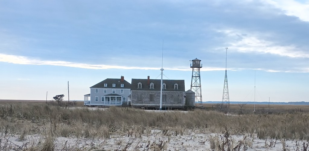
The former Coast Guard station on the north end of Cedar Island has served as one of the Mid-Atlantic region’s long range radar stations since December 2006; however, on February 2, 2020 a storm damaged the power line that carried electricity from the mainland. While an ideal location for the radar because of its proximity to the ocean, housing for the electronics, and access to power needed to run the system, repairing the station proved to be more challenging than expected. The large expense needed to restore and maintain the power line going forward eventually resulted in the permanent disconnection of the island from the power grid, requiring MARACOOS to consider relocating the Cedar Island radar or obtain an alternate source of power.
In order to maintain the most impactful data, it was determined the best solution was to keep the HF radar station in its original location. Old Dominion University (ODU) secured permission from the property owners to install solar power, allowing the station to operate independently. Additionally, the station itself was upgraded to ensure its resiliency for future operations. The system installation took place this past year and the radar station began collecting data again on November 15, 2025.
While working in this remote area remains a challenge, it is well worth it to ensure the proper spacing of radars provides a comprehensive picture of surface circulation in the Mid-Atlantic Bight. We are excited that the Cedar Island station is once again contributing to ocean observations for the U.S. Coast Guard, the public and the research community.
For more information about the data, contact Teresa Updyke (tupdyke@odu.edu).
HF radar data can be viewed and downloaded in MARACOOS Oceansmap.
Collaborators of the project were:
- MARACOOS
- Center for Coastal Physical Oceanography at Old Dominion University
- Teresa Updyke
- The Virginia Institute of Marine Science
- The Folly Creek Corporation
- RECORE
- CoastalObsTechServices
- ODU students and volunteers.

Related Posts
Share this post

